 English
 Tiếng Việt
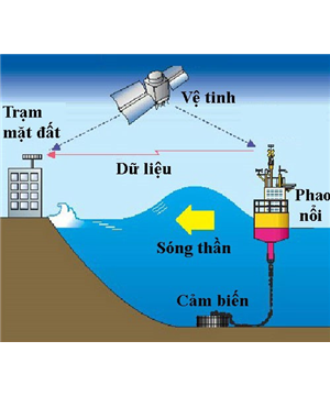
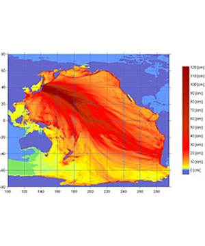
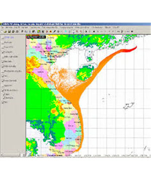
BCT "LP2015" was established for the first time in Vietnam consisting of 3 main modules with 3 different functions: 1) separating the seismic and earthquake groups from the earthquake list to ensure the independence of the events; 2) Statistical forecasting earthquake; 3) Earthquake prediction by combination of geological, geophysical, geomorphic and seismic data. The three modules are linked and aggregated to produce the result that the Mmax maximum earthquake prediction map and forecast event list contain their basic parameters (coordinates, time of earthquakes and its magnitude).
You are contracting for PROGRAM BCT-LP2015- LAND FORECAST ACCORDING TO METHODS: STATISTICS, GEOGRAPHY, GEOGRAPHICAL AND GEOMETRIC
Expert PROGRAM BCT-LP2015- LAND FORECAST ACCORDING TO METHODS: STATISTICS, GEOGRAPHY, GEOGRAPHICAL AND GEOMETRIC
Select an intermediary organization for the product PROGRAM BCT-LP2015- LAND FORECAST ACCORDING TO METHODS: STATISTICS, GEOGRAPHY, GEOGRAPHICAL AND GEOMETRIC


You are commenting for PROGRAM BCT-LP2015- LAND FORECAST ACCORDING TO METHODS: STATISTICS, GEOGRAPHY, GEOGRAPHICAL AND GEOMETRIC